
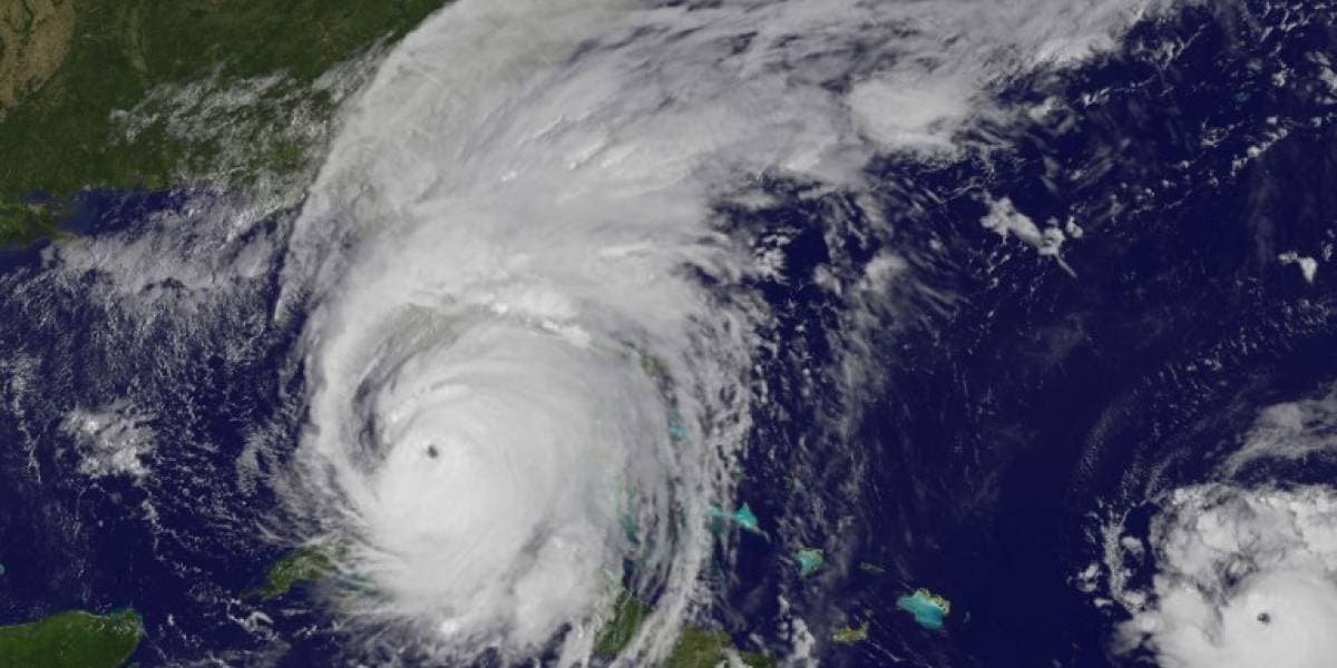
According to the National Hurricane Center, Hurricane Idalia strengthened to a category 4 hurricane before making landfall in Florida on Wednesday morning.
As of 5 a.m. Idalia was said to be 60 miles southwest of Cedar Key and 90 miles south of Tallahassee.
Idalia was travelling north-northeast at 18 mph with maximum sustained winds of 130 mph.
Hurricane-force winds are expected to reach 25 miles from the center. Tropical storm-force winds were reported out to 160 miles from the hurricane's core.
The hurricane's center is forecast to approach the Big Bend coast Wednesday morning, according to the NHC. Following that, it will continue northeast, close or along the shores of Georgia and the Carolinas.
As it stands, it could remain a hurricane by the time it hits the Carolinas, experts said.
According to the NHC, normally dry areas along the Florida coast could see flooding due to “dangerous” storm surges and an enhanced tide from the supermoon. The surges could be as high as 16 feet in some areas.
The following is a list of surges projected for different areas:
- Wakulla/Jefferson County line, FL to Yankeetown, FL — 12-16 ft
- Ochlockonee River, FL to Wakulla/Jefferson County line, FL — 8-12 ft
- Yankeetown to Chassahowitzka, FL — 7-11 ft
- Chassahowitzka, FL to Anclote River, FL — 6-9 ft
- Carrabelle, FL to Ochlockonee River, FL — 5-8 ft
- Anclote River, FL to Middle of Longboat Key, FL —4-6 ft
- Tampa Bay — 4-6 ft
- Middle of Longboat Key, FL to Englewood, FL — 3-5 ft
- Indian Pass, FL to Carrabelle, FL — 3-5 ft
- Englewood, FL to Bonita Beach, FL — 2-4 ft
- Charlotte Harbor — 2-4 ft
- Mouth of the St. Mary’s River to South Santee, SC — 2-4 ft
- Beaufort Inlet to Drum Inlet, NC — 2-4 ft
- Pamlico and Neuse Rivers — 2-4 ft
- South of Bonita Beach to Chokoloskee, FL — 1-3 ft
- South Santee, SC to Beaufort Inlet, NC — 1-3 ft
- Drum Inlet to Duck, NC — 1-3 ft
- Chokoloskee, FL to East Cape Sable, FL — 1-3 ft
- Flagler/Volusia County Line, FL to Mouth of St. Mary’s River — 1-3 ft
- Indian Pass to Mexico Beach — 1 to 3 ft
- Florida Keys — 1-2 ft
A Storm Surge Warning is in effect for:
- Englewood northward to Indian Pass, including Tampa Bay
- St. Catherine’s Sound to South Santee River
A Hurricane Warning is in effect for:
- Middle of Longboat Key northward to Indian Pass, including Tampa Bay
A Tropical Storm Warning is in effect for:
- Chokoloskee northward to the Middle of Longboat Key
- West of Indian Pass to Mexico Beach
- Sebastian Inlet Florida to Surf City North Carolina
A Storm Surge Watch is in effect for:
- Bonita Beach northward to Englewood, including Charlotte Harbour
- Mouth of the St. Mary’s River to St. Catherine’s Sound Georgia
- Beaufort Inlet to Drum Inlet North Carolina
- Neuse and Pamlico Rivers North Carolina
A Hurricane Watch is in effect for:
- Mouth of the St. Mary’s River to Altamaha Sound
- Edisto Beach to South Santee River
Follow Tampa Bay Observer for more updates on Hurricane Idalia.