
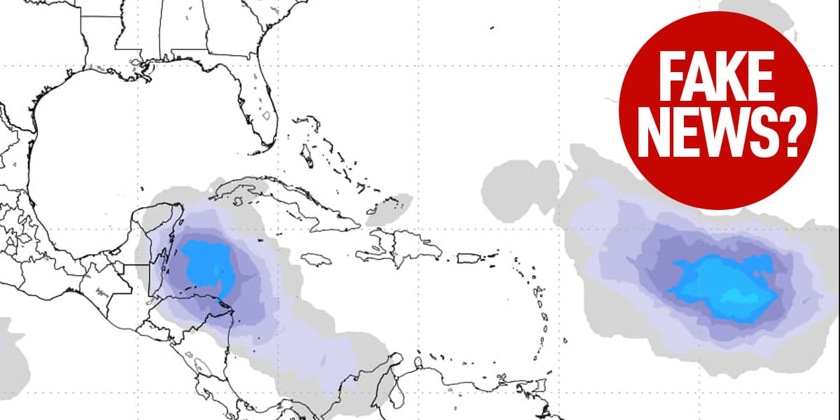
There have been many images shared on social media showing a potential hurricane forming in the Caribbean and heading for Tampa in long-range forecasting.
As of today, there is nothing in the Caribbean or Gulf right now that the National Hurricane Center thinks has a chance of development in the next 7 days. In fact, long range models (both GFS and Euro) show no major storm formation through the end of October.
Bottom line: anyone posting images online of hurricane tracks hitting Tampa over the next few weeks are flat out misleading their audience for clicks.
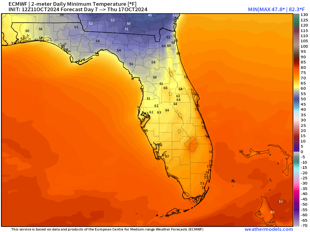
For the first time this year, a true cold front is on the way. Next Thursday the European model shows a forecast low temperature of 62F for our area.
In the interim, we'll continue to see hot weather with highs of 87F over the weekend and into early next week with scattered clouds.